Connectivity & Access
Tumakuru Industrial Smart City: Connectivity — Airports, Highways, Rail & Metro Plans
The Tumakuru Industrial Smart City node, developed by NICDC/NICDIT under the Chennai-Bengaluru Industrial Corridor (CBIC), sits on NH48 about 120 km north of Bengaluru and relies on a mix of an operational national highway and railway station, an under-construction internal road network, and several still-proposed rail and metro upgrades.
| Site location | Vasanthanarasapura, ~120 km north of Bengaluru, ~20 km from Tumakuru city |
|---|---|
| Primary highway | NH48 (Bengaluru–Mumbai/Chennai corridor) adjoins the site — operational |
| Nearest airport | Kempegowda International Airport, Bengaluru — approx. 115–120 km |
| Nearest railway station | Tumakuru Railway Station — approx. 20–25 km from site |
| Nearest port | Mangaluru (New Mangalore) Port — approx. 300 km |
| Internal trunk infrastructure | Roads, minor bridges, storm water drains under construction (as of July 2025) |
| Node infrastructure cost | ≈ ₹1,701.81 crore (EPC scope) |
| Metro/RRTS to Tumakuru | Proposed only — under state cabinet review as of May 2026 |
Airports
Status: operational (existing airport, no dedicated node airport). The Tumakuru node does not have its own airport; it depends on Bengaluru's Kempegowda International Airport. Official project material cites easy access to transportation links such as the Mumbai-Chennai NH-48, Bengaluru International Airport (115 km away), Tumakuru Railway Station (25 km away), and Mangaluru Port (300 km away). NICDC's own project page gives a slightly different reference distance, noting the site is located 120 km north of Bengaluru and 20 km from Tumakuru city, the site offers excellent connectivity via NH-48, nearby railway stations, and Bengaluru International Airport. There is no announced plan for a second airport serving the node itself; all air-cargo and passenger air travel routes through Kempegowda Airport via NH48.
Expressways and highways
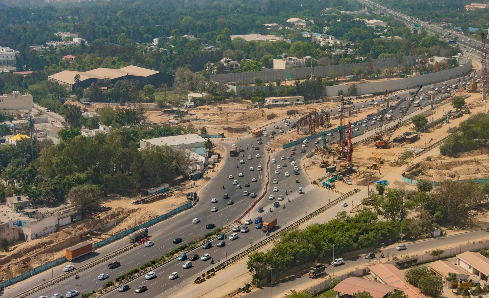
NH48 — operational. The node's principal road link is National Highway 48, the Bengaluru–Mumbai/Chennai corridor, which adjoins the site, with Bengaluru International Airport located further down the same highway corridor. This is an existing, operating national highway, not a new build.
Bengaluru–Chennai Expressway (NE-7) — under construction, regional CBIC link, not a direct node road. A separate greenfield expressway is being built to link Bengaluru and Chennai (the two anchor cities of the wider CBIC corridor), but this runs on the opposite (south-east) side of Bengaluru via Hoskote, not through Tumakuru. As of mid-2026, officials now expect the complete 262.9-km stretch—spanning Karnataka (71.7 km), Andhra Pradesh (85.2 km), and Tamil Nadu (106 km)—to become operational sometime in 2027, with more than 230 km of the corridor completed so far. It supports the broader Chennai–Bengaluru Industrial Corridor logistics network but is not the road that directly serves the Tumakuru site; that role continues to fall to NH48.
Bengaluru internal road upgrades feeding NH48 — proposed/under study. Within Bengaluru itself, authorities are studying a tunnel to relieve congestion at the Tumakuru Road/Outer Ring Road junction, which lies on the route trucks and commuters use to reach the node; as of mid-2026 this remains a proposal. BDA wants to build a 4.5 km tunnel with 6 lanes at Goraguntepalya to help reduce traffic congestion at one of Bengaluru's intersections, and this stretch would connect Tumakuru Road with BEL Circle.
Rail and freight
Tumakuru Railway Station — operational, under redevelopment. The South Western Railway station at Tumakuru is roughly 20–25 km from the node site and already carries passenger traffic. It is now being upgraded: RITES Limited... has announced that the RITES-Aryan Joint Venture has secured a significant contract from South Western Railway for the redevelopment of Tumakuru Railway Station in Karnataka. The scope covers an Engineering, Procurement and Construction (EPC) model, with civil works, signal and telecommunication systems, and electrical general services aimed at modernizing the Tumakuru station infrastructure, and the contract will be completed within 540 days from the appointed start date (contract reported July 2025).
Dedicated Freight Corridor — not applicable to this node. India's Eastern and Western Dedicated Freight Corridors do not run through Karnataka, and no dedicated rail freight corridor has been announced specifically for the Tumakuru node. CBIC planning documents describe freight movement generically as part of multi-modal connectivity, but the concrete infrastructure at Tumakuru today is road- and existing-rail-based rather than a purpose-built freight line.
External rail connectivity into the node — largely undocumented/general. Unlike some other NICDC nodes (e.g., the Haryana IMLH, where a rail-link MoU with DFCCIL is documented), no similar dedicated internal rail spur agreement has been found for Tumakuru as of mid-2026; the node currently relies on the existing South Western Railway line and Tumakuru station.
Metro and RRTS proposals
Namma Metro (Green Line) extension to Tumakuru — proposed, under state review as of May 2026. Bengaluru Metro Rail Corporation Ltd (BMRCL) has prepared a report on extending the Green Line (North–South corridor) from Bengaluru to Tumakuru. Karnataka is on the verge of a transit revolution with a proposal to extend Bengaluru's Namma Metro all the way to Tumakuru... it marks the state's very first inter-district metro service. After the formal submission of a BMRCL report to Karnataka Home Minister G Parameshwara and Chief Secretary Shalini Rajneesh at Vidhana Soudha on Saturday (May 23), the ambitious transit project is now headed straight to the state cabinet for final deliberations. The proposed alignment would cover nearly 60 km from Madavara on Bengaluru's outskirts to Tumakuru along the National Highway corridor, serving residential and industrial clusters in Nelamangala and Dabaspet, with a projected daily ridership of around 3 lakh passengers, and would run through Nelamangala, Dabaspet and Kyathasandra before reaching Tumakuru, with further stations proposed at Tumakuru University, Siddaganga Medical College, Tumakuru Bus Stand and Sira Gate. As of this report, the corridor is planned with 16 stations and could reduce travel time between Bengaluru and Tumakuru to nearly one hour — but it has not been approved by the state cabinet.
Namo Bharat RRTS corridor — proposed alternative, competing idea. A rival option has also surfaced: Bengaluru South MP P C Mohan pointed to the Economic Survey 2025–26 proposal for a Namo Bharat Regional Rapid Transit System (RRTS) corridor between Bengaluru and Tumakuru, arguing that a semi-high-speed rail network would be faster, cheaper and more practical than a long-distance Metro extension. Other experts have instead suggested alternatives such as the RRTS or expansion of the Bengaluru Suburban Rail Project (K-RIDE), including extending the existing Mallige suburban rail infrastructure from Chikkabanavar to Tumakuru using dedicated heavy rail tracks and high-speed MEMU/metro-style AC coaches operating up to 110 kmph. No single option has been finalised as of mid-2026 — Metro extension, RRTS and suburban-rail expansion remain competing proposals.
Bengaluru Suburban Rail (K-RIDE) — under construction citywide, Tumakuru link uncertain. The wider Bengaluru Suburban Railway Project is under construction with two lines targeted to open by December 2026, but a direct Tumakuru extension has a chequered history: Railways stated that the proposed Phase Two of the project, linking Tumakuru and Yeshwanthpur, was not feasible, and after a 2023 rejection of a larger expansion by the South Western Railway zone, a new limited 146 km (91 mi) expansion plan to integrate the network with the proposed circular rail was being planned. A firm Tumakuru suburban-rail commitment has not been confirmed.
Ports
No port at the node — nearest seaport is Mangaluru, ~300 km away. Tumakuru is a landlocked, inland industrial node. Project literature lists Mangaluru Port (300 km away) as the reference seaport for the node's export/import logistics. Within the wider CBIC framework, the corridor overall is described as being near ports like Chennai, Krishnapatnam, and Ennore, supporting efficient logistics — but these southern/eastern ports are several hundred kilometres from Tumakuru itself and serve the corridor's other nodes (Krishnapatnam, Ponneri) more directly than they serve Tumakuru.
Internal road network (within the industrial node)
Under construction as of July 2025. Within the 8,484-acre Tumakuru Industrial Area, trunk infrastructure works are underway for the Phase-A activation area. Government status reports record that the EPC Contractor has been appointed in February 2024 and construction of Major Bridges, Road & storm water drain, utility ducts, External Raw water pipeline & STP in progress. An earlier progress note for the node similarly recorded that the EPC contractor was appointed in February 2023 and has started construction of roads, minor bridges, stormwater drains, utility ducts, and water treatment plants. Separate NICDC monitoring reports describe construction of roads, minor bridge, storm water drain, utility ducts and water treatment plant in progress, with Good for Construction (GFC) drawing submission for approval and road construction under progress. Taken together, the reports show internal roads within the activation area are being built in stages rather than completed; no full commissioning date for the internal road grid has been published.
Scale of works. The node has a total planned area of approximately 8,484 acres across three phases, with a priority activation area of about 1,736 acres (Phase A), and the expected cost of constructing this node is approximately INR 1,701.81 crore, which covers roads, bridges, drainage and utility works for that activation area. Land transfer to the project SPV has reached 1,668.30 Acre land to SPV, with matching equity amounting to Rs. 586.74 Crore released as of the mid-2025 reporting period.
Development phases
Frequently asked questions
Does the Tumakuru Industrial Smart City have its own airport?
No. It relies on Kempegowda International Airport in Bengaluru, cited at roughly 115–120 km from the node depending on the source, with no dedicated airport announced for the site itself.
What is the main highway connecting the node to Bengaluru and beyond?
National Highway 48 (the Bengaluru–Mumbai/Chennai corridor), which runs adjacent to the site and is already operational.
Is there a metro line planned to Tumakuru?
A Namma Metro Green Line extension of about 60 km from Madavara to Tumakuru has been studied and a BMRCL report sent to the state government in May 2026, but it still awaits Karnataka cabinet approval and is not under construction.
Is there a dedicated freight corridor serving Tumakuru?
No dedicated freight rail corridor (like the Eastern or Western DFC) runs through Karnataka or the Tumakuru node; freight currently moves via NH48 and the existing South Western Railway network.
How is the internal road network inside the industrial node progressing?
As of mid-2025 government status reports, an EPC contractor was constructing roads, bridges, storm water drains and utility ducts for the Phase-A activation area, with work in progress rather than completed.
Which seaport serves the Tumakuru node?
Mangaluru (New Mangalore) Port, roughly 300 km away, is the seaport referenced in official project material; there is no port at or near the node itself.
Is the Bengaluru–Chennai Expressway relevant to this node?
It is part of the broader Chennai–Bengaluru Industrial Corridor's logistics network but runs on the opposite side of Bengaluru (via Hoskote); Tumakuru's direct highway link remains NH48, not this expressway.
Sources
- Industrial corridor in Tumakuru inaugurated | Maritime Gateway
- Foundation stone of South India's 1st Industrial Corridor Project laid at Tumakuru | KNN India
- Tumakuru Industrial Area Karnataka | NICDC
- Chennai Bengaluru Industrial Corridor: Latest Updates (2026) | Blackridge Research
- Driving India's Future: Development and Impact of Industrial Corridors | Make in India
- National Industrial Corridor Development Corporation Status Report, 31.07.2025 | NICDC
- National Industrial Corridor Development Corporation Status Report, 30.06.2025 | DPIIT
- Bengaluru-Tumakuru Metro project moves ahead: All you need to know | The Federal
- Bengaluru Suburban Railway | Wikipedia
- Bengaluru–Chennai Expressway | Wikipedia
- Bengaluru-Chennai e-way, meant to cut travel time to 3 hrs, set to miss 3rd deadline due to legal tangle | ThePrint
- Completion of Chennai-Bengaluru Expressway | PIB
- RITES Secures EPC Contract for Redevelopment of Tumakuru Railway Station | Indian Masterminds
- Bengaluru's 4.5-km Tunnel Between Tumakuru Road and BEL Circle | Trade Brains