Connectivity Status
Prabandh Nagar (Prabandhnagar Yojana) Connectivity: Airports, Expressways, Rail, Metro and Roads
Prabandh Nagar Yojana, the Lucknow Development Authority's long-delayed township on IIM Road, sits inside a fast-changing road and transit network built around the city's Outer Ring Road and Green Corridor. This page lists what is actually open, under construction, or still on paper, with dates for each claim.
| Site location | IIM Road, ~15 km from Lucknow city centre (Hazratganj/Kaiserbagh/Gomti Nagar) |
|---|---|
| Nearest airport | Chaudhary Charan Singh International Airport (CCS), operational, linked by metro |
| Outer Ring Road (NH 230 / Kisan Path) | 104 km; over 70% complete as of mid-2025 per NHAI-tracked reports |
| Green Corridor (IIM Road–Kisan Path) | 28 km in 4 phases; Phase 1 (6.8 km) operational since January 2024 |
| Lucknow Metro Red Line | 22.878 km, CCS Airport–Munshi Pulia, operational since March 2019 |
| Proposed metro extension | Munshi Pulia–IIM Lucknow (northward), still at planning stage |
| Reported project area | Reported variously as ~2,100 acres and ~2,500 acres depending on source/year |
| Dedicated freight corridor | None confirmed as directly serving the IIM Road/Prabandh Nagar site |
Airports
Chaudhary Charan Singh International Airport (CCS), Lucknow is the only airport serving Prabandh Nagar's catchment and is fully operational. The airport has an underground metro station on the North-South Corridor of the Red Line of Lucknow Metro, which opened on 8 March 2019. There is no separate greenfield or second airport proposal tied specifically to the IIM Road corridor; access to CCS Airport from Prabandh Nagar is via the arterial road network and the Lucknow Metro Red Line rather than any dedicated new air-link project.
Expressways and Highways
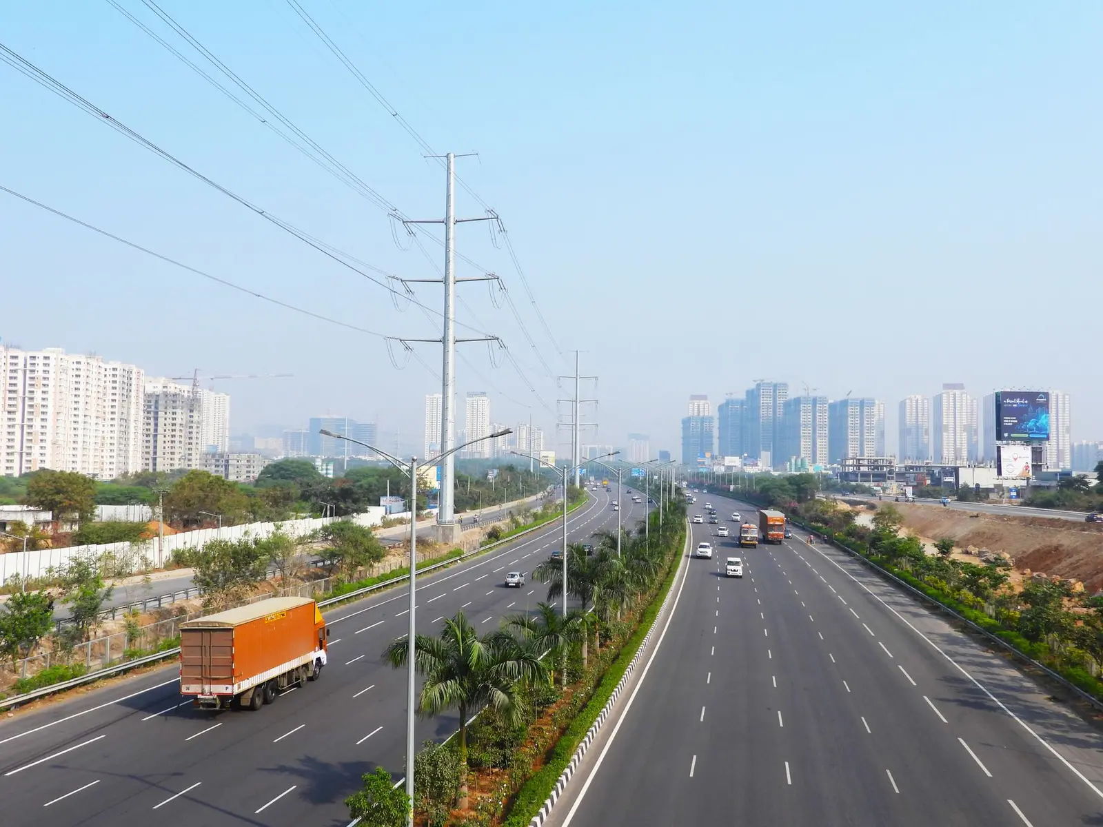
The dominant highway project shaping Prabandh Nagar's connectivity is the Lucknow Outer Ring Road, officially National Highway 230 and locally called Kisan Path. It is a 104 km, eight-lane circumferential highway encircling Lucknow, built to divert heavy traffic away from the urban core, linking key radial roads and national highways including NH-24 (to Sitapur), NH-27 (to Kanpur), NH-56 (to Sultanpur) and NH-30 (to Raebareli). As of mid-2025, several packages had been completed and inaugurated, marking over 70% overall progress on a cumulative project cost exceeding ₹5,000 crore. Separately, industry coverage in late 2025 reported the 104-km Outer Ring Road is expected to be fully operational by the end of 2025 — that completion claim should be treated as a target rather than a confirmed fact until independently verified.
Within the wider Lucknow Master Plan 2031, an Agra Expressway Zone and a proposed Lucknow–Kanpur Expressway are also relevant to the region's road hierarchy. The proposed 63 km six-lane expressway would connect Shaheed Path in Lucknow with Azad Crossing near Kanpur's Ganga Bridge, and is expected to reduce travel time between Lucknow and Kanpur from approximately two hours to about 50 minutes while boosting economic activities along the corridor. This expressway remains a proposal, not an under-construction asset, as of the most recent reporting found.
Other master-plan road items in the same document include an underpass at Awadh intersection, a 7.5 km link road connecting Awadh intersection with Shaheed Path, elevated corridors at Sitapur bypass, and redevelopment of key intersections including Atal Chowk and Polytechnic crossing, plus new Inter State Bus Terminals proposed on Kanpur Road, Ayodhya Road, and Hardoi Road. These are planning-stage items, not confirmed construction schedules.
Rail and Dedicated Freight Corridors
No dedicated freight corridor (DFC) alignment has been identified in current reporting as running through or directly serving the Prabandh Nagar/IIM Road site; Lucknow's DFC-related freight infrastructure lies on other corridors of the national network, not on this specific plan area. On conventional rail, the Lucknow Master Plan 2031 includes a station-upgrade programme relevant to the wider zone: four railway stations — Manaknagar, Alamnagar, Utrethiya, and Dilkusha — are proposed to be redeveloped at an estimated cost of Rs 900 crore to improve passenger facilities and connectivity. This redevelopment is a proposal within the master plan rather than a project under active construction as of the most recent sources.
Metro and RRTS Proposals
The Lucknow Metro Red Line is the only fully operational rapid-transit line in the city. The estimated cost of the project is Rs 6,928 crore and the line covers a total distance of 22.878 km between Chaudhary Charan Singh Airport and Munshi Pulia with up to 22 stations, and the full stretch has been operating since March 2019. This line does not currently run near IIM Road/Prabandh Nagar.
Two extension proposals are relevant but unbuilt: Red Line extensions are proposed from CCS Airport → SGPGI southward, and from Munshi Pulia → IIM Lucknow northward — the latter being the one that would eventually bring metro access closer to the Prabandh Nagar/IIM Road area, though it remains at the planning/DPR stage with no construction start date confirmed. Separately, the Union Cabinet approved Phase 1B, the Blue Line, in August 2025 for ₹5,801 crore, running from Charbagh to Vasant Kunj over 11.165 km with 12 stations, with expected completion by June 2027 — this line serves old Lucknow and western neighbourhoods, not Prabandh Nagar directly. No RRTS (regional rapid transit) proposal has been found linking Lucknow to Prabandh Nagar specifically; RRTS in Uttar Pradesh is currently concentrated in the Delhi-NCR corridor, unrelated to this site.
Ports
Not applicable. Lucknow and the Prabandh Nagar site are landlocked, and no port or inland waterway terminal project has been found connected to this scheme.
Internal Road Network: The Green Corridor
The most directly relevant infrastructure project to Prabandh Nagar itself is the Lucknow Green Corridor, which the LDA describes as the road link achieving non-stop connectivity between the eastern and western parts of the city, anchored at the IIM Road end. The Lucknow Development Authority is constructing the Green Corridor to achieve non-stop quick road connectivity from the eastern to western part of Lucknow city, spanning 28 km and connecting IIM Road to Kisan Path in four phases.
- Phase 1: a 6.8 km stretch from IIM Road to Hardinge Bridge has been operational since January 2024.
- Phase 2: currently under construction, this phase covers a 9.6 km stretch from Hardinge Bridge to Pipraghat Railway Bridge and is crucial for enhancing connectivity between western and central Lucknow.
- Phase 3: this phase covers a 5.9 km stretch from Pipraghat Railway Bridge to Shaheed Path.
- Phase 4: this phase covers a 6.3 km stretch from Shaheed Path to Kisan Path.
Separate reporting in late 2025 put a cost figure and progress marker on part of this corridor: the second phase of the Green Corridor project is progressing rapidly, with 30% of the 1.8-km flyover from Pakka Pul to Daliganj (costing ₹210 crore) completed. Once Phases 2–4 are finished, IIM Road (and hence Prabandh Nagar) would gain a direct signal-free link to Shaheed Path and Kisan Path/Outer Ring Road — but as of the most recent sourcing, only Phase 1 is confirmed operational.
Site Status and Land Acquisition Context Affecting Connectivity Timelines
Connectivity planning around Prabandh Nagar cannot be separated from the scheme's own long-running land-acquisition history, which has repeatedly delayed on-ground progress. The Lucknow Development Authority has been planning to develop a residential area on the Hardoi-Sitapur bypass named Prabandh Nagar, spread across 2,500 acres, including 1,500 acres of residential area and 1,000 acres of a theme park. The project was stuck in land acquisition for years because farmers were not ready to give away their land, demanding higher compensation, and due to this the LDA could not make progress. In September 2019, the LDA agreed to provide compensation to farmers up to double the circle rate, adjusted by increasing the value of the plots.
Reporting from April 2022 described the LDA moving to restart the IIM Road Prabandh Nagar scheme after roughly 14 years stuck, with the completed project expected to provide housing for around one and a half lakh people. A more recent social-media report from mid-2024 cited a smaller footprint and a specific cost figure — a 2,100-acre project costing around ₹4,500 crore, with the farmer compensation dispute resolved — though this figure has not been independently corroborated by an LDA press release found in this research and should be treated cautiously. As of early 2026, the LDA's own master-plan documentation still lists the exact village list for Prabandh Nagar as "final list under process," indicating the scheme's footprint and therefore its precise road/utility tie-ins are not yet fully locked down.
Development phases
Frequently asked questions
Is Prabandh Nagar connected to Lucknow airport right now?
There is no direct metro or expressway link from the IIM Road site to Chaudhary Charan Singh International Airport yet. Access today is via city roads; the airport itself has an operational metro station on the Red Line, running since March 2019.
What is the current status of the Lucknow Outer Ring Road near Prabandh Nagar?
The 104 km Outer Ring Road (NH 230/Kisan Path) was over 70% complete as of mid-2025 according to NHAI-tracked reporting, with some coverage suggesting full operational status by the end of 2025 — a target that should be treated as reported rather than independently confirmed.
Will the Lucknow Metro ever reach Prabandh Nagar?
A northward extension of the Red Line from Munshi Pulia to IIM Lucknow has been proposed, which would bring metro access closer to the IIM Road corridor, but this remains at the planning stage with no confirmed construction start date.
Is there a dedicated freight corridor serving Prabandh Nagar?
No dedicated freight corridor alignment has been found running through or directly serving the Prabandh Nagar/IIM Road site in current reporting.
What is the Green Corridor and how does it help Prabandh Nagar?
The Green Corridor is a 28 km, four-phase LDA road project linking IIM Road to Kisan Path. Phase 1 (6.8 km, IIM Road to Hardinge Bridge) has been operational since January 2024; the remaining phases, which would extend the link to Shaheed Path and Kisan Path, are under construction or planned.
How big is the Prabandh Nagar project area?
Reported figures vary by source and date: one account describes 2,500 acres (1,500 acres residential, 1,000 acres theme park), while a 2024 report cites roughly 2,100 acres at an estimated cost of about ₹4,500 crore. The LDA's own master-plan documents still list the final village list as under process.
Why was Prabandh Nagar delayed for so long?
The scheme was stuck for years over compensation disputes with farmers, who wanted higher payouts than the LDA initially offered. The LDA agreed in September 2019 to pay up to double the circle rate, and reporting from 2022 and 2024 describes renewed efforts to restart the project.
Sources
- Prabandh Nagar – Lucknow Development Authority
- schemes – Lucknow Development Authority
- Prabandh Nagar Project Stuck, Farmers Demand Higher Compensation from LDA | Land Conflict Watch
- Lucknow Index on X (Prabandh Nagar Yojna revival post)
- प्रबंध नगर योजना को अमली जामा पहनाएगा LDA - ETV Bharat
- Lucknow Master Plan 2031 Important Details, Structure and Development Overview - SS Estate Analytica
- Lucknow Outer Ring Road: Status update and route map - 99acres
- Lucknow Outer Ring Road (NH 230) - Grokipedia
- Lucknow Outer Ring Road (NH 230) - Wikipedia
- Special Projects – Lucknow Development Authority
- Lucknow Smart City Revolution: Pioneering India's First AI City And Soaring Skyscrapers
- Chaudhary Charan Singh International Airport metro station - Wikipedia
- Lucknow Metro-Find Route, Fare, Visual map, Travel Time & Distance
- Lucknow Metro Map: Routes & Metro Stations - Maps of India
- Lucknow Metro - Information, Route Maps, Fares, Tenders & Updates - The Metro Rail Guy